Announcing a new EREN initiative: The Macrosystems Ecology for All RCN!
July 27, 2022
From Degraded and Invaded to Restoration and Native {An interview with Rachel Collins}
January 8, 2025EREN Board Member Danielle Garneau put together this brief introduction to the Survey123 app, including examples from her research with undergraduates.
Survey123 is a useful tool for ecology students, faculty, and the community.
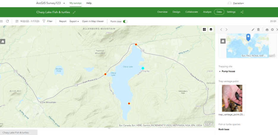
The Survey123 app can be used in research and teaching as a seamless way to geo-reference, capture imagery, and ground-truth, and to link these data using form questions/prompts.
Anyone can use Survey123 user types and many who are in institutions without ArcGIS accounts can still create public surveys — think town planners and those who engage with their communities.
Our intention here is to provide a brief introduction to the Survey123 tool. Below you’ll find a few examples of how Survey123 is currently being used by EREN members and their students, as well as helpful suggestions for how you might integrate this tool into your own research and teaching.
In a Nutshell:
- Survey123 can be used to georeference, capture imagery, and ground-truth, and to seamlessly integrate these data using form questions/prompts.
- After creating an ESRI online account and installing the Survey123 app on your phone, you can: create a group (of collaborators), invite others to join using their usernames, and urge them to contribute data using the app on their smartphones.
Benefits & Suggestions for Use:
Great for Student Work!
Brainstorm goals, hypotheses, questions with students starting their projects. In conjunction with creating a data collection sheet, have students work with you to create a survey using Survey123.
Data are easily accessible for collaboration and for statistical/graphical/geospatial analysis.
Easy access to data. Use data dropdown menu to save as Excel, csv for graphical analysis, or as a shapefile, KML for geospatial analysis.
This can be a cloud storage option and help in data archiving and organization. Website allows users from other sites to see data submitted on the fly (regional, national) collaboration.
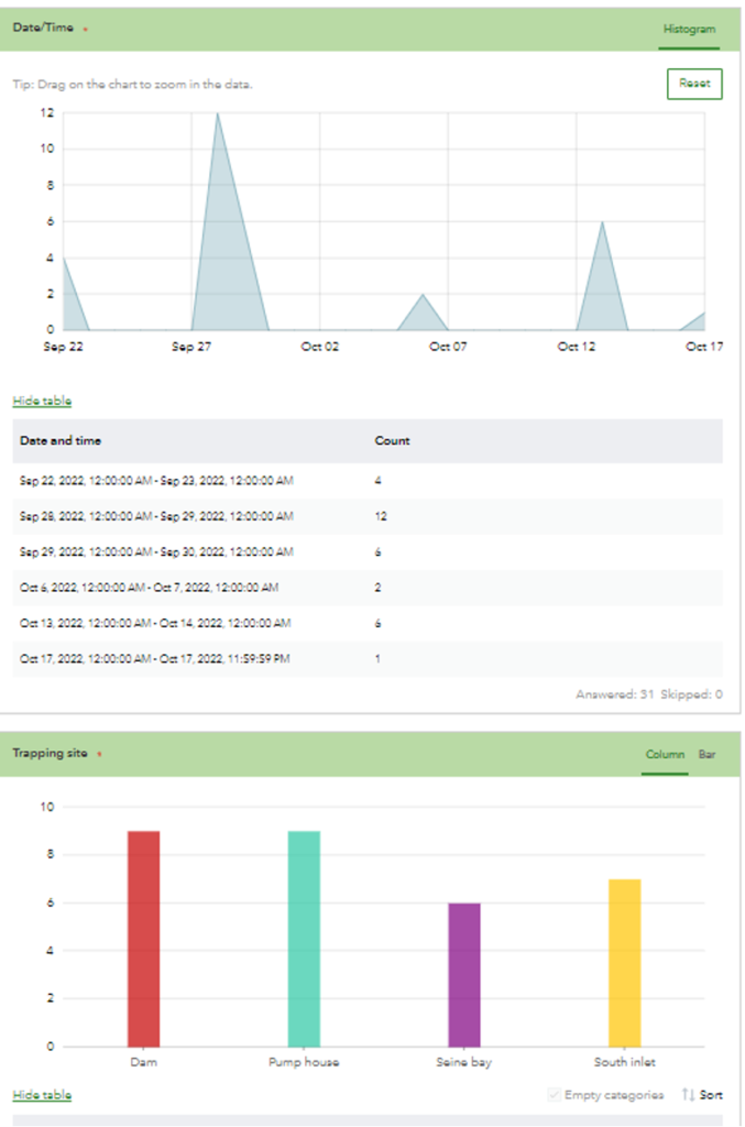
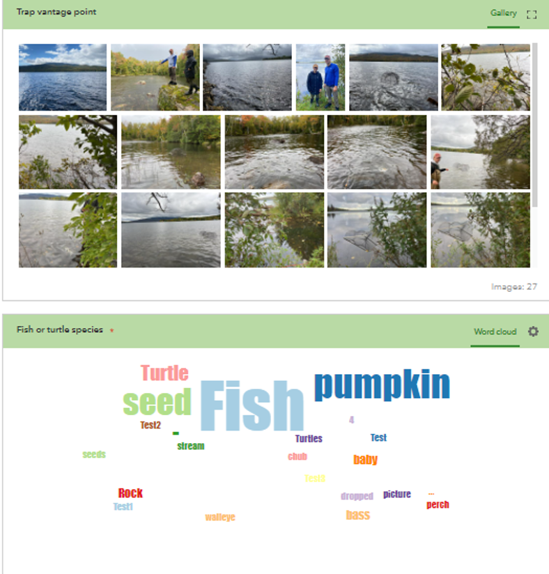
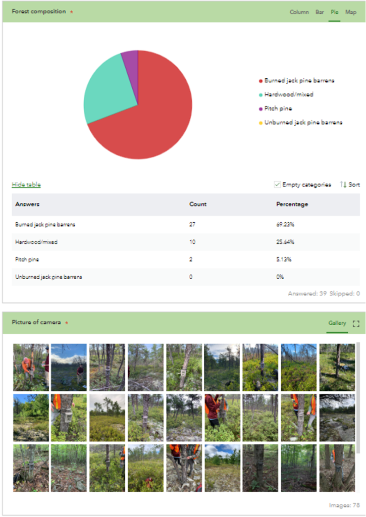
Survey123 includes quick built-in visualization tools.
Analyze menu creates graphs of your form questions, generates word clouds, and stores a compilation of images.
Great potential for addressing macroscale questions.
This tool has great potential for addressing questions at scale (regional, national). Students thinking “big picture”.
A Starting Point for Storytelling.
Data easily interface with ArcGIS online StoryMaps.
EREN members are currently using Survey123 for:
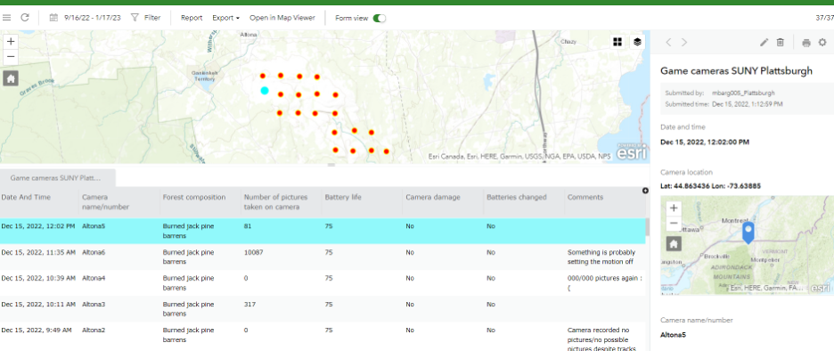
- tracking game camera performance (battery life, # images, snow depth)
- conducting lake surveys (species and abundance, signs of disease, water quality)
- nature trail stewardship
- animal tracking
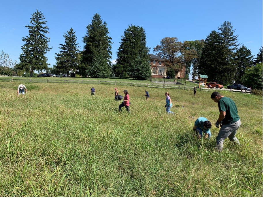
- surveying invasive species presence/absence (jumping worm)
Example : Long-term monitoring using game cameras
Example : Biotic survey of local lake
